


It is May 1st, tinder-dry conditions, high winds and a hot, dry air mass hovered over northern Alberta creating the perfect setting for a small spark to ignite a raging inferno. The largest wildfire to ever effect a populated area in Alberta, began southwest of Fort McMurray. By May 3rd, the fire swept into the city forcing almost 90,000 people to flee as smoke and fire ravaged 2,400 buildings and homes. The wildfire spread across 1,500,000 acres in north Alberta reaching the Saskatchewan border taking out acres of forest and effecting the Athabasca oil sands before declared under control on July 5th, 2016.
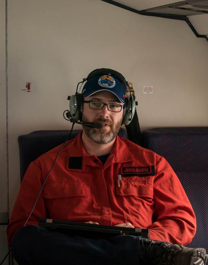
“It’s very easy to look at a fire and say ‘that one is moving really good’ or ‘that one is way hotter than the last one’ or maybe we can get even a bit more specific and measure the amount of fuel- the woody debris on the ground, but if you want to do real detailed research or apply detailed research you need to know explicitly how much hotter this fire was than the other one, or which part of this fire is the hottest part of it- because that tells you things like what parts are going to be the hardest to contain and where it’s going to be easiest to contain. So you really need to have a numerical understanding of a forest fire if you’re going to make the best decisions.” ~ Dr. Joshua Johnston on how numbers tell the fire’s story. Photo Credit: Bo Lu, Natural Resources Canada, Northern Forestry Centre
Dr. Joshua Johnston is a Forest Fire Analyst with Natural Resources Canada’s Great Lakes Forestry Centre’s Canadian Forest Services in Sault Ste. Marie. His area of expertise- fire behaviour and remote sensing. But this mathematician and scientist first acquired his experience with wildfire on the frontline as a firefighter, a profession that has deep roots in his family.
The Fort McMurray fire, which would be referred to in the media as ‘the Beast’, was declared a provincial state of emergency on May 4th. On May 6th, Dr. Johnston was on his way to Alberta and the next day, he was fighting fires again, but this time from a position of 15,000 to 20,000 feet up in the air, wielding his knowledge of infrared energy to identify wildfire hot spots.
The opportunity was a first in wildfire management. With the nation rallying together, every government agency in Canada was scrambling together their resources. Transport Canada (TC) and Environment and Climate Change Canada (ECCC) contacted Dr. Johnston about an aircraft, a dramatically modified Dash-8, which had been designed for the purposes of marine surveillance, breezing over the waters looking for oil slicks or mapping ice in the North. Would the infrared technology built into the aircraft be of value, posited TC and ECCC to Dr. Johnston. Indeed it would.
“It was a first and a very chance encounter. I never knew about these aircraft and the people who operated them, until that fire happened. TC and ECCC were kind of aware that they may have a benefit but they weren’t aware that it could be a significant advantage,” remarked Dr. Johnston. “When I told them it would work they suggested that I join their air crew to ease the transition in working on a wildfire. Their crew had not been in that situation before. I was also able to assist them to get good imagery of wildfire –it’s certainly a different thing to take a picture of, than a base field or an oil slick.”
With the monstrous fire devouring the northern Alberta landscape, a low ceiling of heavy smoke settled in the air, preventing the use of helicopters and other small aircraft to monitor the fire. The re-jigged Dash-8 was able to climb high above the smoke, and out of the way of smaller aircraft fighting the fire, to capture imagery that pinpointed the most troublesome areas of the Beast.

Example of an infrared scan imagery of the Fort McMurray wildfire. Black areas are cloud while white areas are hot. The image was taken during the day and the flame front was actively moving. Dr. Johnston and crew flew the same spot twice a few minutes later and they were able to map the change in the flame front location. Photo Courtesy of Natural Resources Canada
“This aircraft had a system that could directly capture infrared images out of the belly of the aircraft. When you fly forward the scan produces a long strip of imagery –it looks like a photo, but what you’re actually producing is a long, ribbon image. Then you turn around in the aircraft, fly back and produce another really long ribbon and throw them all together.”
An important advantage created by this adapted technology was the ability to monitor the fire in real-time.
“The benefit to us was that we got out there on board this TC aircraft and we were able to fly the fire while it was spreading. A lot of times private contractors fly fixed wing in threat of fires but typically they only do that at night. There’s a lot of reasons for that that are very technical and not the least of which is that they are out of the way of other airplanes. But we were able to fly so high that we were able to do it during the daytime. And by doing that we were able to prove that with this sort of tool in real-time you can actually measure how fast the flame is moving and where it’s going.”
Providing a little Fire Science 101, Dr. Johnston elaborated, “You’ve got to think of fires as a living organism. They change throughout the day and they react to how the day is changing. So when it’s nighttime the sun’s not out, things are a little more damp, the wind tends to calm down and the humidity goes up. So what happens is the fires tend to slow down at night. They may still be flaming but they do tend to move very slowly. And when you wake up in the morning- and as a firefighter I remember this quite clearly, that’s when you are really trying to chase a fire. You’re trying to get a lot of work done before the fire wakes up around mid-afternoon, once the whole morning of drying and heating from the sun is finished the fire is ready to go. And so from early afternoon to early evening fires are spreading aggressively, and that can change with weird weather but typically that’s what they do. They have a cycle throughout the day.”
It’s been routine that data on wildfires is captured via aircraft or satellite though the conventional technology requires 12 to 24 hours to produce the information.
“I can tell you as a guy that’s been on the ground I wouldn’t be entirely thrilled about learning what happened yesterday. You kind of want to know what is happening right now. The system that we were flying out there is very unique- you can process the data in flight.”
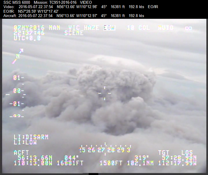
Image of a pyro-cumulous cloud (a thunderstorm type cloud that is formed by an aggressive smoke column during a wildfire). Though the smoke is thick, with infrared technology, scientists can see straight through to the fire. Photo courtesy of Natural Resources Canada, Northern Forestry Centre
There were some limitations in the technology but the opportunity to fly above the Fort Mac fire was a briar rose leading to future innovation.
“There are so many scientific lessons with this fire and because we had so many scientific eyes on it there’s going to be a lot of research for a long time,” commented Dr. Johnston. “What we’re hoping to produce in the future is the ability to process the information while flying and through a satellite down link, email the product directly to the ground crews. That would be pretty cool.”
Also, though possible at the time, the measure of the movement of the fire wasn’t conducted in-flight. “In the aftermath of all of this, we are developing software tools that will automatically measure that. We’re hoping that we’ll be able to offer this as another potential from these scanners –real time fire behaviour monitoring. A lot of times wildfires will spread across the landscape and they’ll hit a hill and they might speed up or they’ll hit a different type of tree and they’ll slow down or they’ll change direction with the wind.”
The Fort McMurray fire was not the largest fire in Canada but it was the single most significant fire that threatened the most people in a residential location in Canada and as Dr. Johnston articulated, fighting a forest fire and a structural fire creates whole new level of complexity.
“There have been bigger fires, more intense fires and faster moving fires but we never had it happen with so many people and so much urban area,” remarked Dr. Johnston.
Often times, wildfires happen in very remote areas where they are managed and when it is possible, these fires are left to their natural life cycle.
“Fires are one of the primary natural disturbance types for forests and are certainly an important part of the Boreal eco-system,” explained Dr. Johnston. “If you look at the Boreal forest, it’s adapted to fire. Species like Jack Pine require fire to keep them regenerating on the landscape. It’s really important to keep the forest renewed and keep that next cohort of trees coming in. A balance is important and that’s why we talk about fire management and not fire suppression.”

Smoke cloud shown above Fort McMurray, Alberta, May 2016. Photo Credit: Bo Lu, Natural Resources Canada, Northern Forestry Centre
Dr. Johnston wrapped up his flying excursion in Alberta on May 13th.
“Alberta has a contract with an aircraft outfit that can do this sort of thing. We wanted to get something going for them and the contractors do an excellent job. Once they became available we stepped back and let them take the reins.”
For Dr. Johnston, attending the fire in Alberta wasn’t just business as usual. His previous profession as a fireman for seven years, and no doubt the camaraderie he shared with his brothers and sisters in red, moved him to reflection. Perhaps more so, the human element at stake stirred mixed feelings as Dr. Johnston eloquently shared his musings of his extraordinary experience.
“I wasn’t expecting to end up back out on a fire any time soon. This was very different. I fought fire for seven years. I’ve seen evacuations, I’ve seen big fires and dramatic fires but this was definitely very, very different…it was just the knowledge of the human component and what’s on the line down there. As a scientist, if that fire had been anywhere else it would have been the most extraordinary thing ever but because of where it was… my mind was up in the clouds watching the smoke and my heart was with the guys down on the ground. And where we were staying in the midst of it all was in Edmonton, in a complex of hotels that were packed with evacuees. So when the flights were ended you were still surrounded by all these people who had been displaced and it was very, very real. I guess I don’t really know how to react to it all. I’ll be processing it for a while. But at the end of the day, I was really happy that even though I’m not a firefighter anymore that the research we are doing is helping these people and it’s still relevant to the folks on the ground. In my opinion, if you are doing government research and that research is valuable to the people on the ground who are trying to do the operations and it helps the people of Canada, then you must be on target with what you are doing. It was bittersweet I guess. We got to collect the data that we wanted for a long time but it was certainly not the way we wanted to collect it.”
*****
(feature image: Dr. Joshua Johnston waits to board the fixed wing infrared sensor aircraft in Edmonton, bound for Fort McMurray, Alberta, May 2016. Photo Credit: Bo Lu, Natural Resources Canada, Northern Forestry Centre)
![]()
1 Comment
Hit it out of the park….very interesting article Steffanie